PRESS RELEASE: Award winners to receive access to next-generation satellite imagery for biodiversity conservation
The Connected Conservation Foundation and Airbus Foundation are proud to announce the winners of its Satellites for Biodiversity Award and launch of a Masai Mara Satellite Sandbox to accelerate the application and learning of using VHR data for safeguarding endangered species and natural ecosystems from space.
Seven transformative conservation projects will receive access to Airbus’ new generation of very high-resolution satellites, with three finalists receiving USD 5,000 of financial funding to drive forward species conservation and human and wildlife coexistence.
These projects aim to safeguard vital habitats by collaborating closely with local communities, fostering a collective effort to safeguard ecosystems that also play a crucial role in sequestering climate-altering carbon emissions.
The winners are:
- The Asian Institute of Technology is coupling AI and high-resolution satellite data to inform local conservation management of the Asian Elephant habitat in Thailand's Sai Yok National Park.
- The Tree Kangaroo Conservation Program (TKCP), to help local communities use satellite data to protect vital habitats for the endangered Matschie's tree kangaroo, Eastern long-beaked echidna and nearly 5,000 fauna and flora species in Papua New Guinea's YUS Conservation Area.
- The Elephant-Human Relations Aid (EHRA) to predict and prevent human-elephant conflicts between Namibia's desert elephants, communities and local farmers.
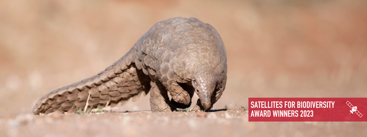
- Masai Mara Satellite Sandbox, to support local conservation teams working in Masai Mara, Kenya. Four runners-up, working in the same region, are being awarded Pleiades Neo satellite data to help protect Giant Pangolins, map invasive species, create better wildlife connectivity and plot land boundaries to deploy geo fences for elephant trackers in an attempt to stop the human-wildlife conflict.
“We are thrilled to support these forward-thinking conservation projects in applying high-res satellite imagery, provided by the Airbus Foundation, to help conservation teams and local communities protect and preserve our planet's biodiversity," says Sophie Maxwell, Executive Director of Connected Conservation Foundation.
She added, "This Award is opening up the accessibility of these game-changing technologies to local conservation initiatives. With the new 30 cm resolution imagery, teams now have access to the new visibility of features including elephant paths, boundaries and previously unseen harmful human activities. These are important in helping save some of our most vulnerable species.”
A wealth of applications were evaluated by a selection committee of some of the biggest representatives from the Earth Observation, AI and Conservation Technology sectors. Applications were assessed for innovative use of satellite data to address pressing conservation challenges, alongside the project team’s resources and technical skills, project feasibility and pathway to conservation impacts
“Through our collaborative efforts, we aim to accelerate techniques and stop the duplication of efforts, ultimately maximising our impact in the fight to protect endangered species and ecosystems,” says Rachel Schroeder, Managing Director of Airbus Foundation.
“We are committed to advancing the application of these increasingly accessible tools is unwavering, and we are excited to see the impact of these winning projects.”
Masai Mara Ecosystem Mosaic
To extend the partnership’s commitment to biodiversity conservation from space, Airbus Foundation and CCF are enabling a Satellite Sandbox for the Masai Mara in Kenya.
With many of the runner-up applicants based in the Masai Mara ecosystem, alongside the wealth of conservation and academic research and expertise in this region, the partnership has announced it will provide a 30 cm Pleiades Neo Mosaic of the entire Masai Mara ecosystem, which will be available to four runners up to advance their research and conservation programmes.
This project extension, aims to accelerate the application and learning of using Earth Observation data and AI for conservation, alongside sharing and building local GIS skills in the Global South, helping organisations including the Centre for Ecosystem Restoration Kenya, Mara Elephant Project, Langland Conservation, and Geoxfinity.
The programme's goal is to mature, test and scale up the use of satellite and IoT remote sensing tools to address biodiversity, climate and coexistence challenges. The partners aspire to make all application learnings and technical solutions as accessible as possible to the conservation community.
A grant to boost high-resolution satellite exploratory and conservation learning
Airbus Foundation and CCF are thrilled to announce the return of the Satellites for Biodiversity Award at the end of 2023. In round two the partnership is excited to award more applicants in their efforts and consolidate learnings across grantees to maximise the role remote sensing can play in biodiversity conservation.
The Satellites for Biodiversity Award is part of a larger initiative by the Connected Conservation Foundation and Airbus Foundation to leverage satellite technology for environmental and conservation purposes.
The winners in more detail:
Saving Gentle Giants: Habitat risk mapping of wild elephants in Sai Yok National Park
The wild elephant population in Thailand's Sai Yok National Park has dwindled to 3,500 due to illegal poaching, habitat loss and human pressure. As the majority of the local population relies on agriculture for their livelihood, the expansion of farmland, combined with the fuelwood demand, has led to rapid deforestation and fragmentation of the elephants' habitat. To address this issue, the Asian Institute of Technology has initiated a project to map the elephants' habitat using high-resolution satellite data and advanced machine learning algorithms.
The team will assess habitat loss in the Sai Yok reserve forest between 2012 and 2022. By comparing high-resolution satellite images taken over the last 10 years, they will identify the extent of ecosystem degradation, determine the impact of invasive species like eucalyptus on the elephants' food sources and detect changes in the landscape over time.
The project aims to provide valuable insights for local communities, conservation charities, farmers, policymakers and stakeholders to devise effective conservation laws and sustainable management plans for coexistence between the elephants and the residents of Sai Yok National Park.
"This funding and advanced satellite imagery will allow us to delve deeper into the complex issues surrounding the elephant habitat in Sai Yok National Park,” says Dr Arnirban Mukhopadhyay, project lead from the Asian Institute of Technology.
“By unveiling the most precise and accurate pictures of the habitat issue, we can pave the way for targeted conservation strategies that will ensure the long-term survival of these incredible animals.”
High-tech heroes saving Tree Kangaroos and Echidnas in Papua New Guinea
The lush and rugged landscape of Papua New Guinea is home to the endangered Matschie's tree kangaroo and the critically endangered Eastern long-beaked echidna. With their populations dwindling due to habitat encroachment and illegal activities, these rare creatures desperately need help.
The Tree Kangaroo Conservation Program (TKCP) will integrate on-the-ground community-led monitoring data with drones and new high-resolution satellite imagery to give an up-to-date understanding of threats across the landscape. Helping communities share local knowledge and make collaborative decisions on environmental issues, use of natural resources and plan sustainable land use across the mighty 162,683-hectare YUS Conservation Area.
Members of the community will be responsible for patrolling the area and gathering on-the-ground data, which will then be superimposed onto the satellite imagery to pinpoint areas of focus. These local landowners will record observations, activities and potential threats within designated zones, enabling a more comprehensive and accurate understanding of the conservation needs of the region. The TKCP and community engagement efforts will help prevent selective harvesting of timber, maintain wildlife corridors, and enhance reforestation and revegetation, ultimately preserving the rich biodiversity of the area.
“Combining local, indigenous knowledge with the latest in technology, we will be able to help protect these endangered species and help the local landowners to be stewards of their forest and wildlife,” says Lisa Dabek, Senior Director of the Papua New Guinea Tree Kangaroo Conservation Program. “We are grateful for the opportunity to work with Connected Conservation Foundation and Airbus Foundation to access the next generation satellite imagery.”
Saving Namibia's Desert Elephants
In the harsh and arid landscapes of northwest Namibia, there is ongoing human-elephant conflict, leading to devastating financial losses for farmers and, tragically, is the main cause of the declining elephant population. Only 21 desert elephants remain today.
The Elephant-Human Relations Aid (EHRA) will use the new satellite imagery and funding alongside direct surveys to map the movements and motivations of Namibia's desert elephants to find long-term solutions for human-elephant coexistence.
This never-before detailed analysis will map each property across the landscape, including fences, land uses, rivers, water points and main elephant pathways. Satellite data coupled with elephant movement data will inform where EHRA can test elephant-friendly fences at entry points and designate new elephant corridors, to increase the survival chances of the free-roaming elephant population. The outcomes of this work will contribute to conservation projects run by EHRA and the Ministry of Environment, Forestry, and Tourism (MEFT), aiding the expansion of the corridor project and ultimately creating a more harmonious future for both elephants and farmers in Namibia.
“This grant will really speed up the data collection we need to pinpoint and test coexistence solutions, helping to save elephants’ lives,” says EHRA’s Conservation Program Manager, Christin Winter.
ENDS
NOTES TO EDITORS:
About Airbus Foundation
The Airbus Foundation provides access to Airbus’ unique portfolio of high-tech products, services and know-how to help address some of the world’s most pressing problems, contributing to sustainable solutions for a safe and united world. The Foundation prioritises its actions around 3 strategic areas - Humanitarian Aid, Youth Development and Environment - developing partnerships with NGOs and associations around the world to deliver its missions.
About Connected Conservation Foundation
Connected Conservation unites the capabilities of technology companies to equip local partners with game-changing tools for nature protection and restoration. CCF brings essential connectivity, communications and sensing devices to vast landscapes, enabling conservation managers to pre-empt and stop poaching, habitat loss and human-wildlife conflict in protected areas. Find out more at: https://connectedconservation.foundation