
Conserving the last nesting habitats for endangered crocodilians and river turtles
Partners: Wildlife Conservation Trust and Airbus Foundation
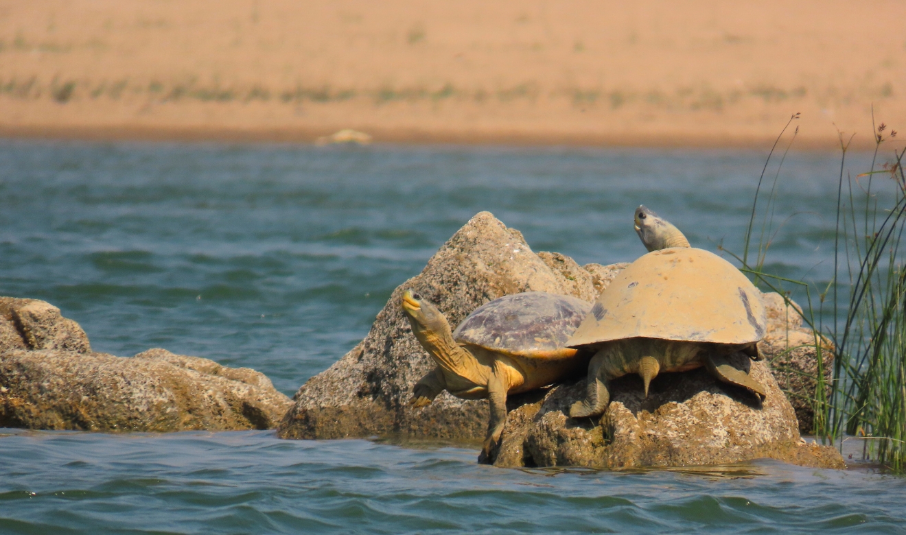
Key Species: Gharial, Three-striped roofed turtle, Red-crowned roofed turtle, Indian narrow-headed softshell turtle, Indian softshell turtle and Indian peacock softshell turtle
Key Ecosystems: Rivers, wetlands and floodplains
2025 Award Winner
Spanning the Indo-Gangetic plains—one of the most densely populated and agriculturally important regions on Earth—the Gangetic Basin is an intricate network of rivers, wetlands and floodplains that sustain hundreds of millions with food, water and livelihoods. These dynamic ecosystems regulate climate, recharge aquifers and nourish biodiversity, anchoring ecological and human resilience.
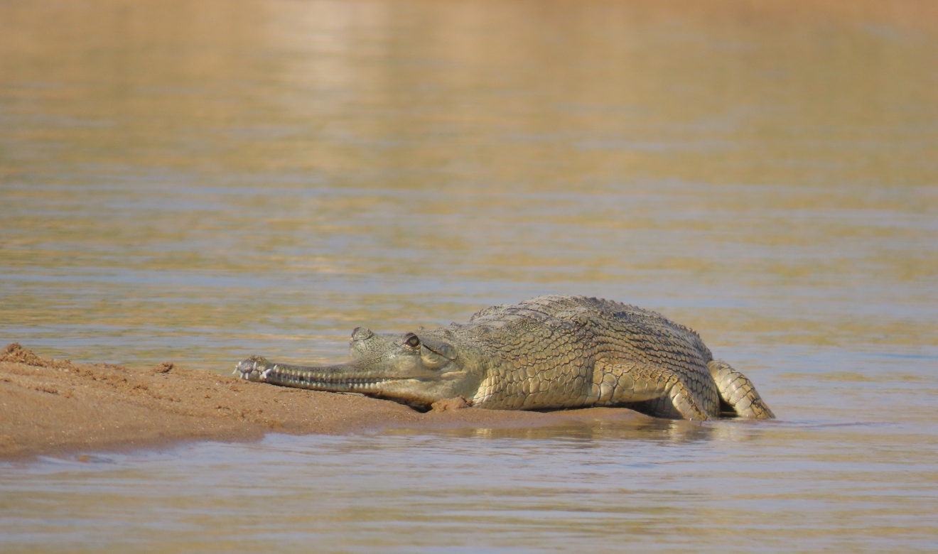
Ancient species under threat
Among their most ancient residents are freshwater reptiles. The critically endangered Gharial, a fish-eating crocodilian endemic to South Asia and several threatened turtle species cling to the brink of existence in just a few fragmented strongholds across rivers like the Chambal, Son, and Ghaghra. Yet, illegal sand mining, pollution, dam-modified flows, and encroaching floodplain developments are decimating these vital river ecosystems. Nesting banks are vanishing, and wetland habitats are drying up. Without swift, scientifically informed, and pragmatic conservation action, these species and the ecosystems they help regulate may disappear.
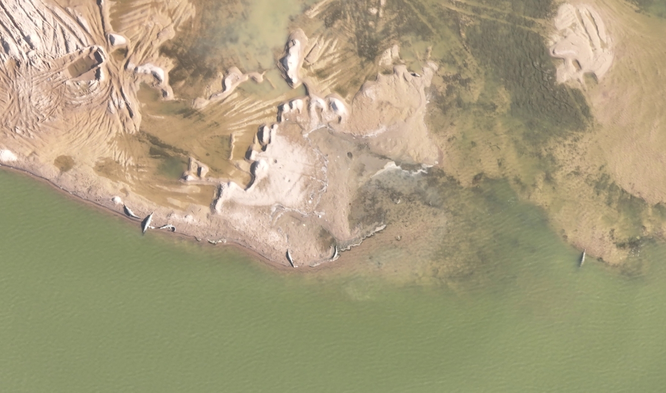
From space to the shoreline
With support from the Connected Conservation Foundation and Airbus Foundation, the Wildlife Conservation Trust is pioneering a high-tech conservation initiative to designate protection of key nesting habitats of these ancient reptiles. Using high-resolution satellite imagery, combined with AI and detailed fieldwork, the team will identify and safeguard critical habitats like alluvial sandbanks and mid-channel islands—areas vital for basking, nesting and hatching for species like the Red-crowned Roofed Turtle and Narrow-headed Softshell Turtle, species and habitats difficult to monitor from the ground.
Mapping hidden nesting grounds
Seasonal satellite imagery, captured during nesting and hatching periods, will track habitat changes caused by unseasonal flooding, erosion, sand mining and encroachment. Field teams will complement this data with drone footage, on-the-ground surveys and past occurrence records from literature, thus validating satellite models by mapping nesting depressions and collections of subsurface basking pits. These insights will train AI and machine learning models to help automate the detection of reptile habitats for scaling satellite-based conservation across India’s diverse river systems.
A blueprint for effective river conservation
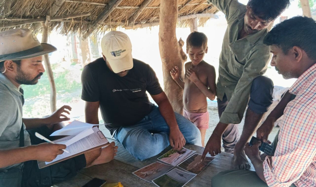
The Wildlife Conservation Trust aims to raise awareness among local communities, government agencies and NGOs about critical nesting sites and the extent of habitat loss. By delivering precise and actionable data, this project strives to inform conservation decisions and support enforcement efforts.
Long-term goals include achieving net-zero loss of nesting habitats and ensuring any habitat lost to threats like sand mining or erosion is offset through restoration or protection, so there's no overall decline in nesting area. The project also aims to curb illegal sand mining and support local communities through conservation-based livelihoods and sustainable ecotourism. Findings will be shared and integrated into platforms like India Sand Watch to inform policy and community action.
![]()