
Monitoring habitats and dugongs from above
Partners: Dugong and Seagrass Research Station and Airbus Foundation
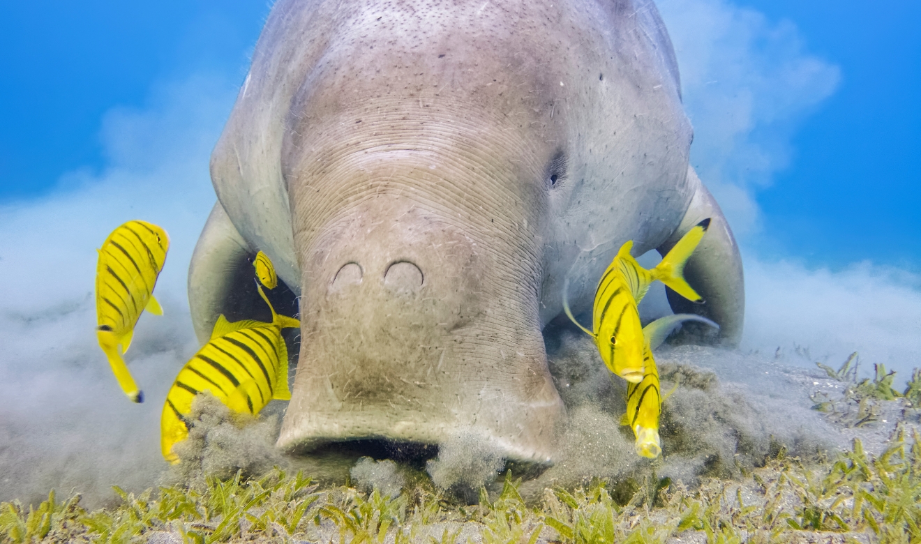
Key Species: Dugong
Key Ecosystems: Seagrass meadows, nursery habitats and underwater canopy
2025 Award Winner
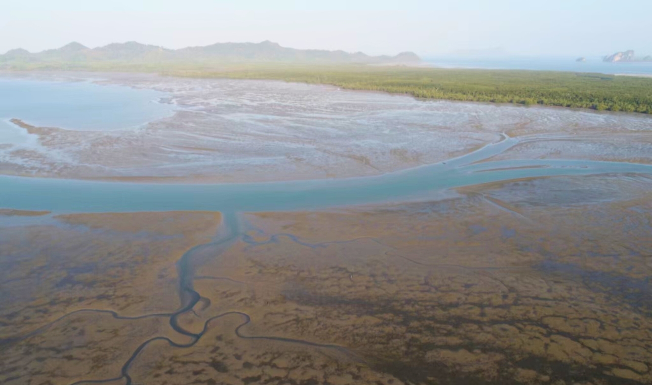
In the crystalline waters of Thailand’s Andaman coast, seagrass meadows bloom beneath the waves, acting as nurseries for marine life, sediment stabilisers and carbon sinks. They are a lifeline for local communities—providing food, livelihoods and coastal protection—and for one of the ocean’s most elusive mammals: the dugong
But these delicate underwater ecosystems are vanishing. Development, pollution, warming waters and many other factors are taking their toll. Globally, around 29% have already disappeared. And with that, dugong populations have plummeted.
In Thailand, the impact is stark. Along the Andaman Coast, dugong strandings have more than doubled—from an average of 20 per year (2019-2022) to 42 per year (2023–2024). Alarmingly, 40% of these were found emaciated, particularly around the Trang coast, suggesting widespread food scarcity. Aerial surveys echo this decline, with calf sightings dropping from 9% of the population in previous years to just 3% in 2024.
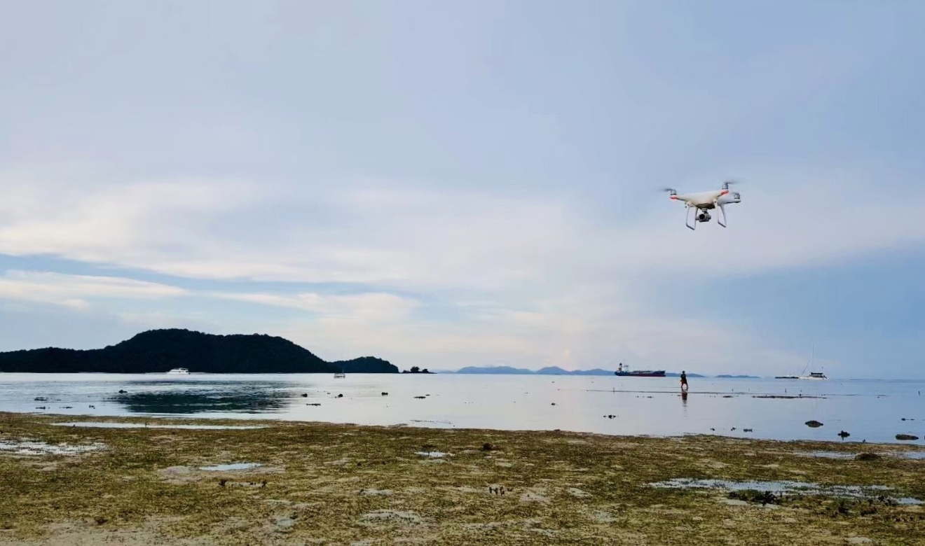
A view from the sky
The Dugong and Seagrass Research Station, with satellite support from the Airbus Foundation and funding and technical support from the Connected Conservation Foundation, is pioneering a high-tech conservation strategy. Using high-resolution Pleiadés satellite imagery and drone surveillance, the team will map historical and current seagrass meadows to quantify loss and the distribution of dugongs to help identify critical areas for restoration.Data that dives deeper
Drones will enable monitoring of dugong populations, providing vital insights into their migration routes, feeding habits and population density. Meanwhile, machine learning algorithms will analyse satellite imagery to detect seagrass presence and track changes over time, cross-referenced with historical, field-based seagrass reports.Community monitoring with heart
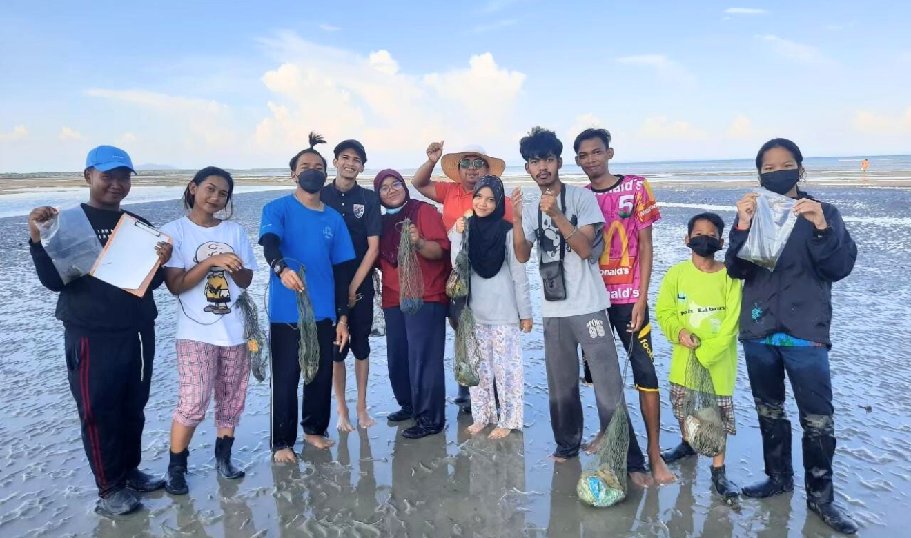
At the core of this project is the empowerment of coastal communities. Through citizen science and training workshops, residents and NGOs will be equipped to provide validated field reference points of seagrass coverage and monitor dugong sightings, boosting data collection and local environmental stewardship.This multi-layered approach—blending satellite intelligence, machine learning, community knowledge and drone footage—will help pinpoint priority areas for restoration and reveal the connections between seagrass loss and the decline of dugong populations and help protect these important carbon sinks.
Actionable science, scalable impact
By bridging critical knowledge gaps in seagrass distribution and dugong population dynamics, this project delivers high-resolution habitat maps and real-time wildlife insights. Community-led monitoring ensures local ownership, while long-term collaboration with Thailand’s Department of Marine and Coastal Resources will help shape national strategies for biodiversity protection and coastal climate resilience.