
Ecosystem Insight Hub launches to Accelerate AI and Very High-resolution Satellite Imagery for Nature
The Connected Conservation Foundation and Airbus Foundation launch the Ecosystem Insight Hub to accelerate innovative conservation methods that integrate very high-resolution satellite imagery, Artificial Intelligence and field data to monitor and protect nature, for people and the planet.
Published 12 May 2025
Six pioneering new projects have been awarded to mark the launch, totalling 15 active initiatives across 13 countries, all supported through the 'Satellites for Biodiversity' grant scheme.
By integrating the exceptional detail of Airbus’ Pléiades and Pléiades Neo satellite imagery (at 15 HD, 30 cm and 50 cm resolution) with AI, in-situ data and community-led conservation, these initiatives enable new positive ecosystem and biodiversity actions. Projects synthesise data to empower field organisations to make informed, landscape-scale decisions. By reshaping conservation planning, mitigating human-induced threats and supporting communities in managing natural resources, they help foster a future where people and wildlife can thrive together.
The Ecosystem Insight Hub
Helps practitioners replicate successful AI-driven approaches and spotlights scalable solutions for far-reaching impact. It promotes collaboration by openly sharing methods, analysis and learnings from all projects.
2025 Satellites for Biodiversity Award Winners
Projects developing promising new use cases:
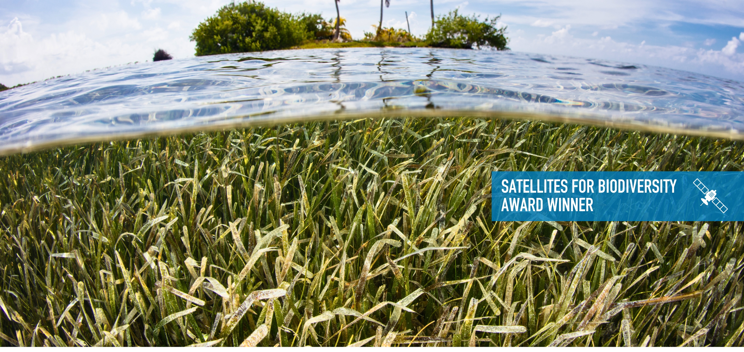
Seagrass loss mapping, Dugong and Seagrass Research Station, Prince of Songkla University, Thailand
Mapping seagrass loss along the Andaman coast to protect the endangered dugong population and crucial carbon sinks.
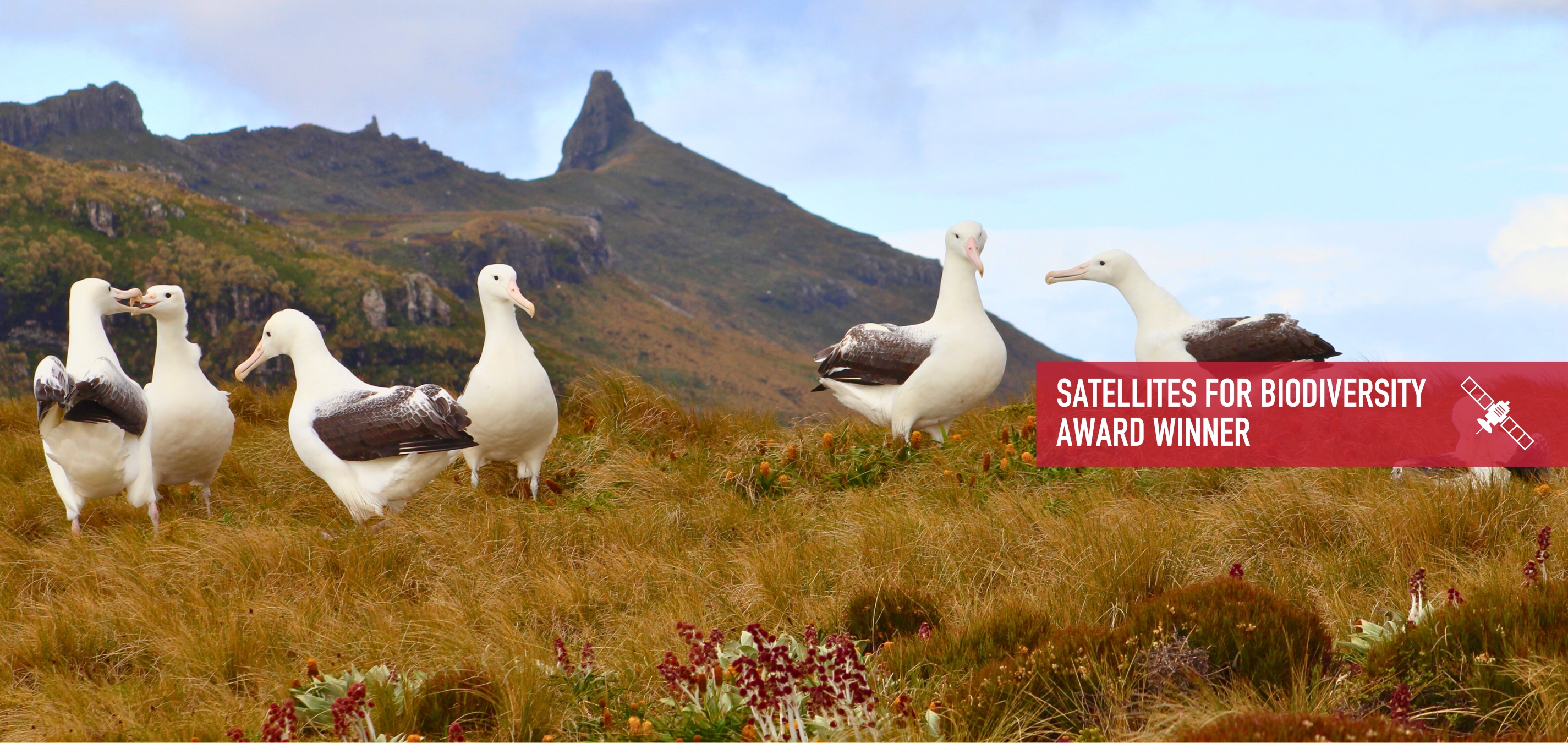
Southern Royal Albatross monitoring, Victoria University of Wellington, New Zealand
Estimating the critically endangered population, providing crucial insights into breeding outcomes and informing future conservation strategies.
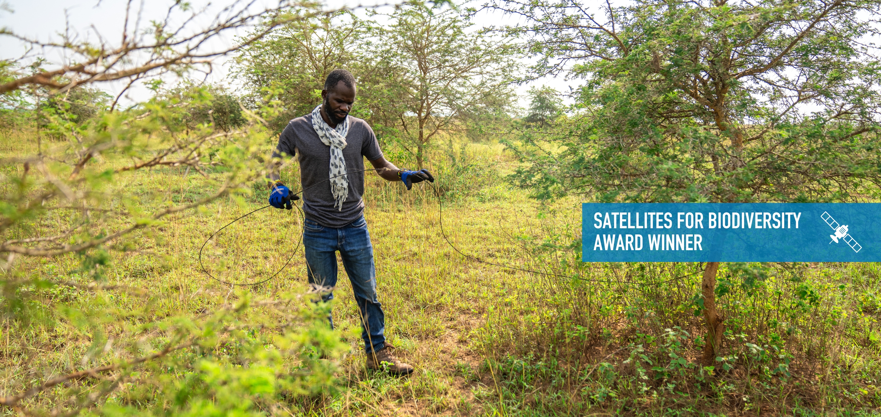
Smarter anti-snaring efforts, Innovation For Conservation (ICON) Programme, Uganda
Identifying snaring hotspots in Murchison Falls National Park, enabling swift interventions to protect vulnerable wildlife.
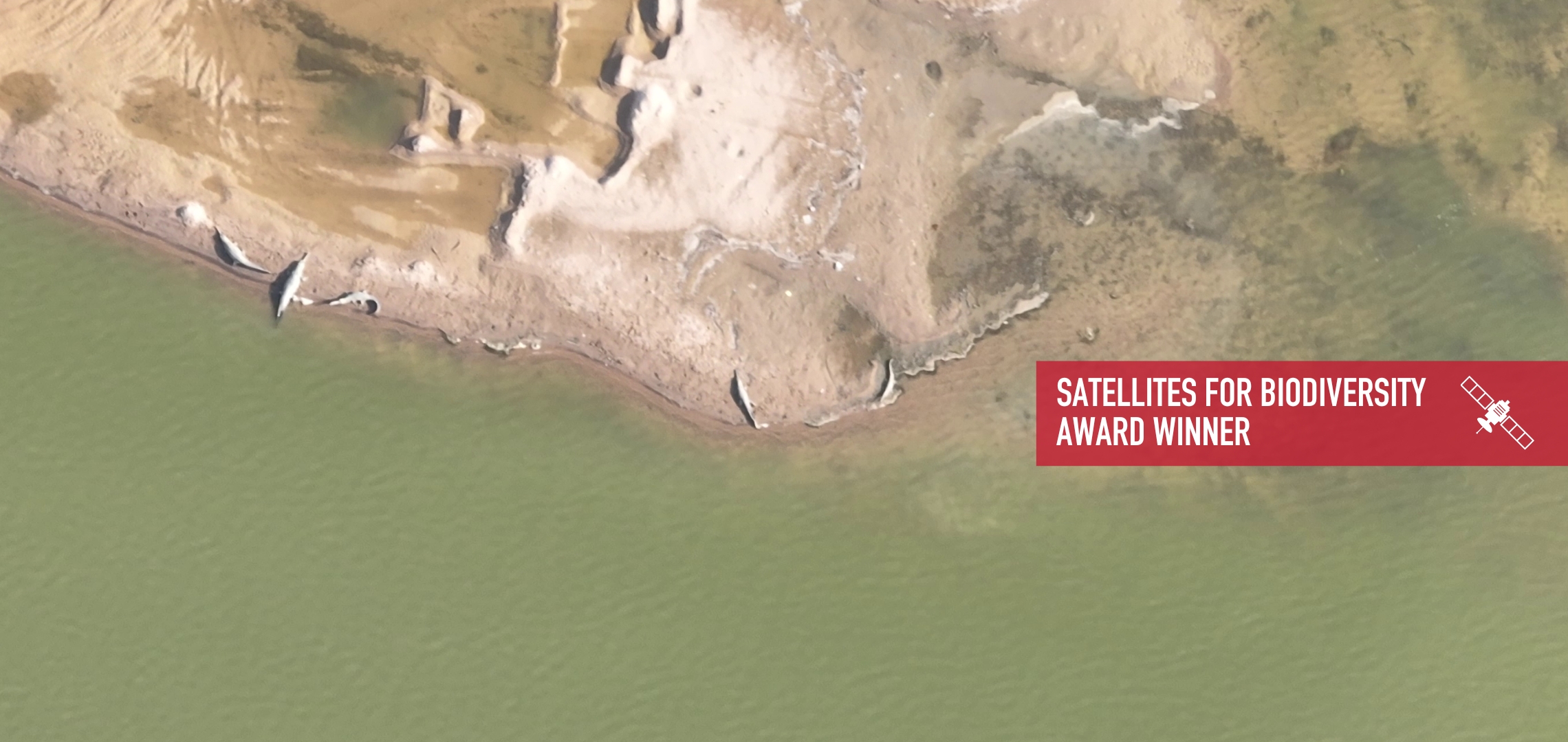
Riverine ecosystem protection, Wildlife Conservation Trust, India
Estimating the critically endangered population, providing crucial insights into breeding outcomes and informing future conservation strategies.
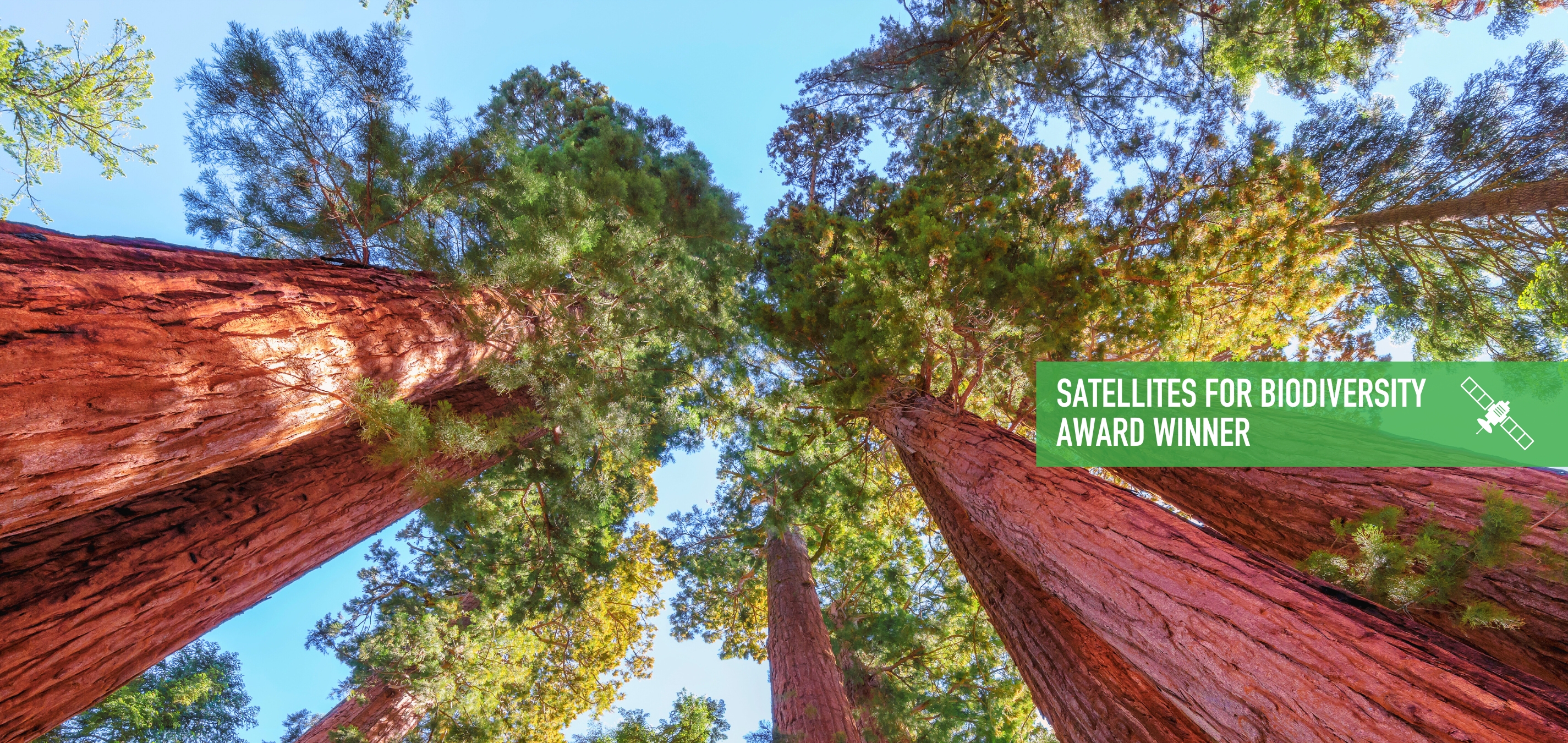
Defending Giant Sequoias from invasive species, Conservation X Labs, USA
Creating an early warning system to support public and private landowners against bark beetle infestations.
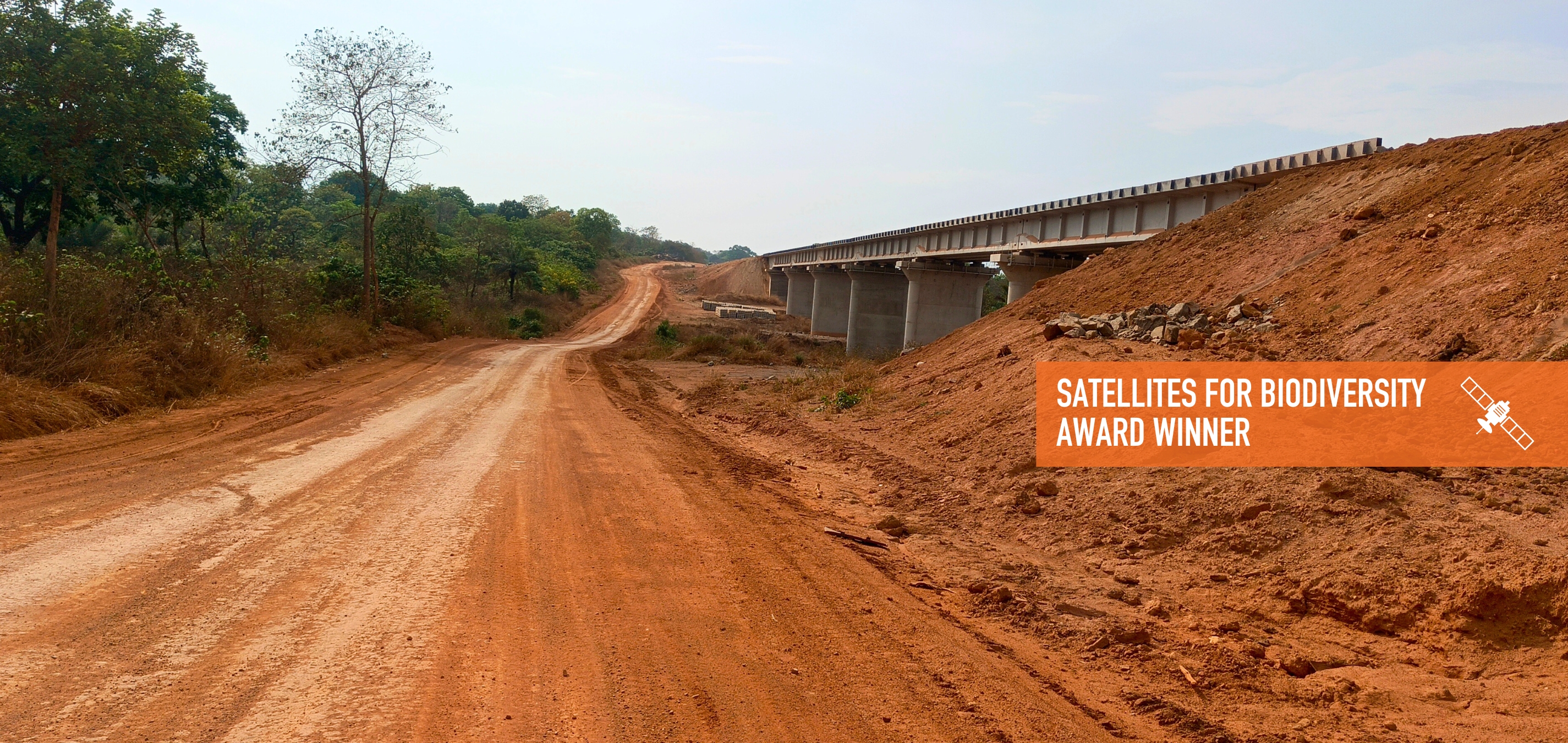
Managing commercial pressures on Guinea’s forest, Wild Chimpanzee Foundation, Guinea
Restoring vital wildlife habitats and displaced chimpanzees disrupted by major infrastructure projects, promoting long-term biodiversity resilience in Guinea’s forests.
Once completed, the insights and findings from all Satellites for Biodiversity award-winning projects will be added to the Ecosystem Insight Hub, providing a steady stream of new applications and knowledge for the conservation and Earth Observation community year after year.
“Nature can’t wait, and protecting it requires deep collaboration,” said Sophie Maxwell, Executive Director of Connected Conservation Foundation. “The Ecosystem Insight Hub provides an AI-focused resource helping practitioners accelerate replicable methods and cutting-edge techniques applied to high-resolution satellite imagery that align with global policy frameworks and inform decisive, on-the-ground impacts.”
“Airbus Foundation is committed to leveraging cutting-edge technology for the benefit of our planet,” said Hania Tabet, Airbus Head of Social Value and Airbus Foundation Managing Director. “The integration of Airbus’ high-resolution satellite imagery with AI in-field insights is providing conservationists with critical data to address the urgent challenges facing biodiversity. As the application of these tools accelerates, so can our impact. By facilitating a more precise understanding of ecosystem dynamics, we can drive more effective conservation strategies and ensure a healthier future.”